Isle Of Wight
We cruise gently down Southampton Water leaving the noise and bustle of the city behind. The fast ferry zips by, rushing to the island in half the time, but we have the time to indulge in a cooked breakfast as the refinery at Fawley passes the window. Top tip - head straight for the cafe as soon as you board, as a queue forms.
After an hour we come to land at Cowes, at the mouth of the river Medina. Its surprisingly industrialised here, but on a small friendly scale with places like the boatyard painted here.

...buy the print from Redbubble.com

You want to see the hovercraft in colour? Well join me as the tide recedes and we can walk right out on the beach, far from the shore. It looks like one is just about to depart...
With the tide so far out it feels like you could walk to Portsmouth. You can't of course, and do beware that the tide comes in fast here. Lets at least head back up the beach a bit past a large natural pool where families play in the safe shallow water.

... buy the print from Redbubble.com
At high tide, the sea comes in much further up the beach. The families that were playing in the shallow pools are forced to just a narrow band until the tide turns again. And around here that takes time, for the double high tide of this region means that the tide only retreats shortly before low tide.


As you walked along the beach did you spot the folly? It should have been pretty obvious - especially if its the day of 'Shipwreck Isle', the pirate festival. But for now its quiet.
Anyway, here's a painting of it from the woods and another from the shore, and without the pirates.

I knew you would ask - so here is the Shipwreck Isle pirate festival in full swing. So many female pirates, and so many Jack Sparrow lookalikes - it could all be quite confusing - especially after a few tequila sunrises from the bar. And just who is that looking very out of place in a Southampton shirt?

The best way on from Ryde I've found is to follow the coast, past the folly where the pirate festival was held, and round several bays, each quieter than the last. You eventually pass some rocks and enter a bay with no buildings bar these two shacks, and if you time it right, no people too.
This is Priory Bay - named after the priory that sits behind the woods you see. In the background you may just catch a glimpse of Portsmouth and the spike of the Spinnaker Tower.

Our route takes us around a corner to the remains of a church, painted white as a landmark visible from the sea. Beyond, a cafe sprawls and a large area of flat grassland lies between the sea and the harbour. Catch it on an early summer day and you may just come across a large spread of foxgloves like the ones painted here.
Across the grassland we come next to a narrow path that cuts across the water without us getting our feet wet.

An old mill stands at the far end of the path across the sea. From there its just a matter of following the road around the edge of the harbour. The cycle round the island goes this way too, so don't be surprised if a few whizz past.
A renowned sea food restaurant occupies one of the first house boats. There used to be a whole row of quirky and somewhat ramshackle house boats along this shore, but sadly they've now been entirely replace with soulless floating blocks of glass and metal.
The Tollbooth Cafe at the end has sadly gone too, but lets leave that all behind as we follow the shore (tide permitting). Passing the lifeboat station on a pier, the shore has been left largely natural...

We have to leave the shore as the cliff starts, as there is no route round the next corner. So we climb up to Bembridge village, then past the windmill. Next the airfield (with its Propeller Inn an alternative refreshment stop), and a climb over the hill to the seaside resorts of Sandown and Shanklin.
The pier at Sandown is well worth a visit. Walking through its corridor is like a trip into the past. Its split into sections, and the most evocative is perhaps the cafe I've painted here (oil on board, 8x8 inches, 2018). though sadly even that has lost a little of its charm now.

The beach continue on to busy Shanklin, and then peters out into a rougher shoreline round about at this groyne. Its a good spot for a view, as you can make out Shanklin Chine as a green belt with a building half way down the cliff. But don't look too close as its not possible to get much detail at this scale!
We need to get off the beach now, for a path through the woods.

... buy the print from Redbubble.com
We skirt one of the highest peaks on the island, and come out on the cliffs just above Ventnor. South facing with cliffs and a hill behind, this spot has its own micro climate, and often boast hot sunny weather when the rest of the country wallows in cloud. Lets go have a look. The town has such potential but is largely unchanged in decades. But the beach basks in a special light where even the fine shingle appears to glow...


... buy the print from Redbubble.com
Continuing along the coast path we come to the delightful little Steephill Cove, a delightful fishermans cove that has kept its charm despite it now being a tourist spot..
Beyond that we have the botanic gardens and an increasingly rocky shore with a cliff behind a narrow coastal strip. We eventually have to climb that before we reach Blackgang.
St Catherines point marks the Southernmost point of the island with high cliffs and a view across a deep blue sea (oil on board 10x12 inches, 2020). However the last time I cycled this route, the nearby road (which reaches the highest point on the route here) was bathed in low cloud.

Its downhill for a while now, followed by the long and straight military road that follows the coast. The official cycle route goes inland a bit here, but with a tail wind this is too good to miss. For those cycling the island there is a stiff climb at the end which is getting perilously close to the cliff edge, but nevermind, there is icecream to be had in Freshwater Bay, and a chance to paddle on the shingle beach.
If the tide is out (as here) you get colourful rockpools in front of the big lump of chalk guarding the bay. And just to the left of these you can walk round to some caves. But do take care, its chalk worn smooth by the sea, and its wet. And there is nothing more slippery than wet chalk - as I suddenly remember when I slipped straight into a rock pool, filling my boots with seawater.

...buy the print from Redbubble.com
With extra time to dry off those boots (well I did warn you the chalk was slippery), and sample another ice cream (all money going to the RNLI), we finally get under way.
We are on foot now, for the climb up Tennyson Down. Looking back we get this view of the cliffs stretching back to St Catherine point, except that the path has all but gone now due to erosion, and we are on a safer path a little further from the edge. Ahead, just a lush carpet of grass, wildflowers, blue butterflies and near silence.

Its a long walk along the ridge - it takes me about an hour to reach the far end. But there we come to a little hidden spot - a place where rockets were tested when Britain was in the Space Race. You can freely walk around at present, and even enjoy a vertiginous view from the end of the cliff. A few signs have recently appeared, and there is a small cafe and visitor centre round the corner. I suspect one day we'll have to pay to see this.

Around the corner we come to the official tourist sites with a huge car park and a thousand ways to empty your wallet. So lets skip that and head down the road to a path up Headon Warren. Lets head on over the top surrounded by flowering heather and a restored calmness.
Our walk reaches a road, but then descends quickly to the promenade around Totland Bay. With the mainland fort of Hurst castle in the background and a shallow sea before us there is a mediteranean feel. but all too soon we are pushed inland, and don't emerge until we reach the quaint village of Yarmouth. The best view is from the ferry, but we are not yet ready to leave the island.

... buy the print from Redbubble.com
Had we taken the shortcut from Freshwater Bay along the old railway line (now a pleasant cycle / footpath) we would have entered Yarmouth from another direction and seen this view, which has featured in much tourist bumpf.
The large building is an old tide mill, many of which can be found around the country.

We leave Yarmouth heading East. At first its along the shore, but we get pushed onto the road, and then various tracks across soft mud cliffs, and then gravel tracks past unseen houses. When we reach the shore again its on a shingle beach called Hamstead Duver. And there the view suddenly opens to reveal the Newtown River - a flooded system of creeks offering a sheltered and scenic place to sail.


From the last spot there is a path that winds around the creek, before getting back on those gravel tracks we hate. They take us to a busy road, where we can either jump on a bus to Newport, or turn off again (at Shalfleet) to visit Newtown itself. From there its a lot of road walking to the shore near Gurnard and back to Cowes.
We've now followed the coast right rounds, but neglected the centre. You can walk along the river Medina for that, or just jump on the bus. There are shops and lots of bustle, but you can escape that if you head to Carisbrooke. And close to there I found this green lane on the Shepherd's Trail.

From Newport, back to Cowes, we just have time for a wander along the shore, past all the little shops and the little brass canons of the Royal Yacht Squadron. We come to a promenade with a low wall and stone lions guarding the beach. Beyond that lies Gurnard, and a walk along a wilder section of shore before we emerge at The Luck. To go any further we are detoured inland. So this is a good spot to admire the jumble of boats at low tide, before turning back to Cowes. And this is where we say goodbye to the island.

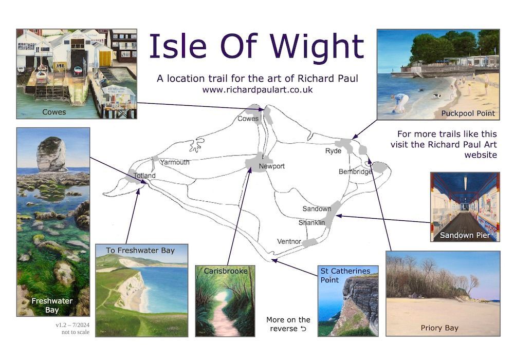
A map to help you explore
Get a printable double sided version of this trail, and use it to explore the island and the views I've painted. Its completely FREE so long as its not for profit.
PDF file 46Mb

I hope you've enjoyed our little trip around the island. I'm thinking of putting together a book in a similar style taking you around the whole of Britain in a number of journeys - recreating what I've done on this website, but with lots more story in the journey. Do let me know if its something you would like to read, as it may spur me into getting it done.
Prints of my Isle Of Wight paintings can be found at Redbubble.com